History
The History of LCRVHC and our sister club the BPC (Bridle Path Conservancy)
Written for our 50 year anniversary celebration and also published in Trailblazer Magazine
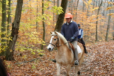
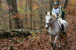
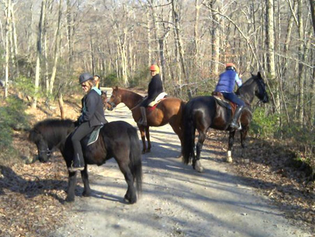
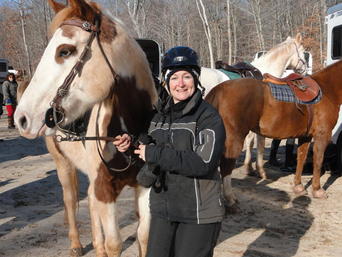
The Lower Connecticut River Valley Horsemen’s Club (a 501c 07 corporation) was incorporated in 1962 by a group of friends who were interested in taking care of local trails and riding together on weekends. They would meet in each other’s living rooms and swap horse stories between tackling club business. An annual horse show was a source of revenue and a very large undertaking for the small group. For many years, an ECTRA sanctioned 25-mile Competitive Trail ride expanded their list of events. LCRVHC members (especially the Elliott family) worked hard to influence the state’s purchase of the Weber Woods section of Cockaponset from the Weber family when Dr. Weber passed away and developers were interested in the land. Currently about 75 members strong, we hold monthly meetings (usually with an educational program), almost-monthly member-only rides (sometimes on private land), and an annual Fall Hunter Pace in Weber Woods (open to the public), as well as almost-monthly trail work parties, and potlucks and parties for our members. Quite a few of our members are also active in the Connecticut Horse Council’s-Volunteer Horse Patrol program.
Written for our 50 year anniversary celebration and also published in Trailblazer Magazine
The Lower Connecticut River Valley Horsemen’s Club (a 501c 07 corporation) was incorporated in 1962 by a group of friends who were interested in taking care of local trails and riding together on weekends. They would meet in each other’s living rooms and swap horse stories between tackling club business. An annual horse show was a source of revenue and a very large undertaking for the small group. For many years, an ECTRA sanctioned 25-mile Competitive Trail ride expanded their list of events. LCRVHC members (especially the Elliott family) worked hard to influence the state’s purchase of the Weber Woods section of Cockaponset from the Weber family when Dr. Weber passed away and developers were interested in the land. Currently about 75 members strong, we hold monthly meetings (usually with an educational program), almost-monthly member-only rides (sometimes on private land), and an annual Fall Hunter Pace in Weber Woods (open to the public), as well as almost-monthly trail work parties, and potlucks and parties for our members. Quite a few of our members are also active in the Connecticut Horse Council’s-Volunteer Horse Patrol program.
In 2004, in light of the heavy development in our area, our concerns for the loss of trails we had ridden for decades became extreme. We researched converting our club from a 501c 07 to a 501c 03 for the purpose of trail preservation and ended up spinning off a separate 501c 03 corporation from our trails committee. The mission statement follows:
The Bridle Path Conservancy is a non-profit group dedicated to the preservation, enhancement and acquisition of multi-purpose, passive-use, recreational trails on public and private land in Connecticut and southern New England. While the Conservancy was founded by equestrian enthusiasts, it seeks to support all open space and trail initiatives. By managing, educating, and cooperating with others to create opportunities to facilitate and preserve trails, the Conservancy strives to keep recreational land available for present and future generations to enjoy.
The Bridle Path Conservancy is a non-profit group dedicated to the preservation, enhancement and acquisition of multi-purpose, passive-use, recreational trails on public and private land in Connecticut and southern New England. While the Conservancy was founded by equestrian enthusiasts, it seeks to support all open space and trail initiatives. By managing, educating, and cooperating with others to create opportunities to facilitate and preserve trails, the Conservancy strives to keep recreational land available for present and future generations to enjoy.
Our first year a very real threat to equestrian enthusiasts came up when the state proposed that equestrians would only be permitted on trails that were specifically designated and marked as multi-use trails. Over 100 horsey folks turned out on a cold January night for a meeting to discuss how to address this threat. Several of us went to Hartford and testified in support of the CHC counter proposal that all trails should be considered multi-use unless specifically marked otherwise (blue trails are still foot traffic only). Our members worked alongside the CHC to map/evaluate trails in our area and all over the state for suitability for equestrian use. Eventually the CHC proposal passed allowing us to use virtually all the trails in the state parks and forests of Connecticut.
Brad Turley, Pat Martin, and Kristin Elliott Leas were the first leaders of the BPC. A non-membership organization depending on LCRVHC for manpower and motivation, the BPC was able to do some fund-raising among the LCRVHC membership and obtain some grants for tools and supplies. Early grants included funds from ELCR (Equestrian Land Conservation Resource) and NEMBA (New England Mountain Bike Association). We also partnered with the Connecticut chapter of NEMBA and the Deep River Sprockids on some projects. We started out by replacing 3 rotting or non-existent bridges in Weber Woods in the summer of 2005. We formed/nurtured relationships with local land trusts (especially those in Clinton and Westbrook, but also Killingworth and Lyme) and helped them with trail work including building some more bridges. We also gained some “cred” with the folks from CFPA (Connecticut Forest & Parks Association), teaming up with Rob Butterworth for National Trails Day events--working on the orange trail for several years. In 2009 we replaced a multi-use bridge on that trail. Are you hearing a theme here? Thanks to architect, Tom Elliott, Kristin’s dad and long-time member, for the design, engineering, and project management!
Brad Turley, Pat Martin, and Kristin Elliott Leas were the first leaders of the BPC. A non-membership organization depending on LCRVHC for manpower and motivation, the BPC was able to do some fund-raising among the LCRVHC membership and obtain some grants for tools and supplies. Early grants included funds from ELCR (Equestrian Land Conservation Resource) and NEMBA (New England Mountain Bike Association). We also partnered with the Connecticut chapter of NEMBA and the Deep River Sprockids on some projects. We started out by replacing 3 rotting or non-existent bridges in Weber Woods in the summer of 2005. We formed/nurtured relationships with local land trusts (especially those in Clinton and Westbrook, but also Killingworth and Lyme) and helped them with trail work including building some more bridges. We also gained some “cred” with the folks from CFPA (Connecticut Forest & Parks Association), teaming up with Rob Butterworth for National Trails Day events--working on the orange trail for several years. In 2009 we replaced a multi-use bridge on that trail. Are you hearing a theme here? Thanks to architect, Tom Elliott, Kristin’s dad and long-time member, for the design, engineering, and project management!
|
|
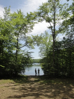
Then, in addition to maintaining Weber Woods Trails, we started looking for ways to link-up existing trails and greenways. We looked at maps showing open space and tried to make sense of it in the woods. One day Alex Sokolow (DEP-Park & Recreation Supervisor for Cockaponset SF, Chatfield Hollow SP, Wadsworth Falls SP) and some of his mountain-biking friends got together with Brad and Kristin (on horseback) and (GPS in hand) bushwhacked their way north from Weber Woods to Beaver Meadow Road in Haddam, connecting a series of trails ranging from well-traveled to almost over-grown. We started calling this the “Epic” trail and continued to work on it. Working with Alex and the folks from DEP we mapped it and campaigned for acceptance as a designated trail. Finally late in 2008 we received word, the state had accepted the now-named Quinimay Trail! (Quinimay roughly means long path in the Pequot language.) In 2009 we clipped, cleared, and marked the Quinimay Trail from one end to the other, culminating with a ribbon-cutting ceremony on National Public Lands Day in September. There is still plenty of work to be done, water bars and armoring to be installed, erosion risk areas to be taken care of, and the never ending clipping and removing of blow downs but it’s ride-able (horse or bike) and hike-able now and the more it gets used the better it will be. Look for the tan and green plastic multi-use markers placed above the colored trail blazes.
In late 2010 we received a grant from the DEP Bureau of Outdoor Recreation, State Parks Division, allowing us to purchase a Muck Truck walk-behind motorized wheelbarrow and a Stihl Kombi-Tool with brush cutter, pole saw, and string trimmer attachments. To obtain this grant we had to match the funds with an equivalent number of hours in volunteer time. We purchased the machines in Spring 2011 and debuted the new “wee truckee” at National Trails Day in June 2011 where it was used on a trail armoring project on the white trail.
In late 2010 we received a grant from the DEP Bureau of Outdoor Recreation, State Parks Division, allowing us to purchase a Muck Truck walk-behind motorized wheelbarrow and a Stihl Kombi-Tool with brush cutter, pole saw, and string trimmer attachments. To obtain this grant we had to match the funds with an equivalent number of hours in volunteer time. We purchased the machines in Spring 2011 and debuted the new “wee truckee” at National Trails Day in June 2011 where it was used on a trail armoring project on the white trail.
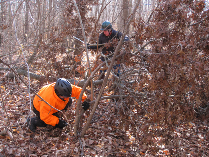
Our members logged hundreds of hours clearing storm debris and remarking trails in Weber Woods, local land trusts, and along the Quinimay Trail following Tropical Storm Irene and the Halloween Nor’easter snowstorm in 2011 and Hurricane Sandy in 2012 and we expect we will be putting in many more hours when the snow finally melts after the Blizzard of 2013.
We have armored stream crossings and trails, rerouted trails flooded by beaver dams or eroded beyond usability, repaired trails damaged by “mudders” and ATV and dirt bike traffic as well as tried to spread the word by teaching other groups how to share and maintain multi-use trails.
Future plans (or dreams) include creating a brochure about the Quinimay Trail with a mpa to be placed at the trailheads and on the DEEP’s web site, someday perhaps establishing a horse camp at the old sand pit near the north end of the Quinimay Trail, extending the trail south (maybe to Long Island Sound?) and north (maybe to link up with the MMM Trail?) and of course, maintaining what we have, and continuing our equestrians as good trail ambassadors program.
